The Kidney problem actually made me delve a bit deeper into this.
According to wikipedia, "
...was Tel el Aqqaqir, the base of the Axis defence roughly 3 mi (4.8 km) northwest of the Kidney feature and situated on the Rahman lateral track." and "
Kidney feature (also known to the Germans and Italians as Hill 28), often wrongly called a ridge".
So if, we look at
this map and compare it with Google maps, we get this:
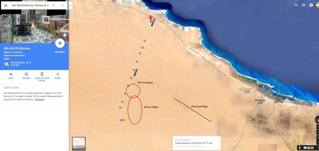
Since the Kidney ridge is apparently more of a hill rather than a ridge, finding it is pretty much impossible in Google satellite view, and I'm guessing the Egyptians don't have any publicly available topographic maps of the area.

